Byter Robyn T sent me an email in which she expressed her enjoyment of old time and historical photographs. It occurred to me that having been posting about Sydney’ suburbs, with collections of old photographs, I have been overlooking the rich trove of rural and coastal New South Wales. Today’s post starts a new occasional series called Out and About in NSW. Because Robyn lives in Maclean, that is the first place featured.
MACLEAN
Location:
Maclean is a town in Clarence Valley local government area in the Northern Rivers region of New South Wales, 658 km (409 mi) north of Sydney and 46 km (29 mi) north of Grafton. It is on the Clarence River and near the Pacific Highway.
Name origin:
The Maclean area was known as Rocky Mouth in the 1850s by reason of the rocks at the mouth of the river. It then became known as Big River. The township was officially laid out in 1862 and named after Alexander Grant McLean, the Surveyor-General who carried out the survey work. The spelling was, however, altered. In 1862 it officially became a town and was named Maclean.
About:
At the 2016 census, Maclean had a population of 2,628.
Maclean is nestled at the base of Mt Maclean and the shoreline of the Clarence River where the river reunites after splitting around Woodford Island. A bridge connects Woodford Island to Maclean. During times of heavy rain the town is under threat of flooding by the surging waters of the river but it is now protected by a levee bank which runs beside River Street
Maclean refers to itself as "The Scottish Town in Australia”, based on a large number of the early settlers in the valley having originally come from Scotland and that the town was named after a Scot.
Since 1903 the town has held the Maclean Highland Gathering where pipe bands, caber tossing, wearing of kilts, a parade down the main street and highland dancing are part of the celebrations. The 2020 event was however cancelled for the first time in its history.
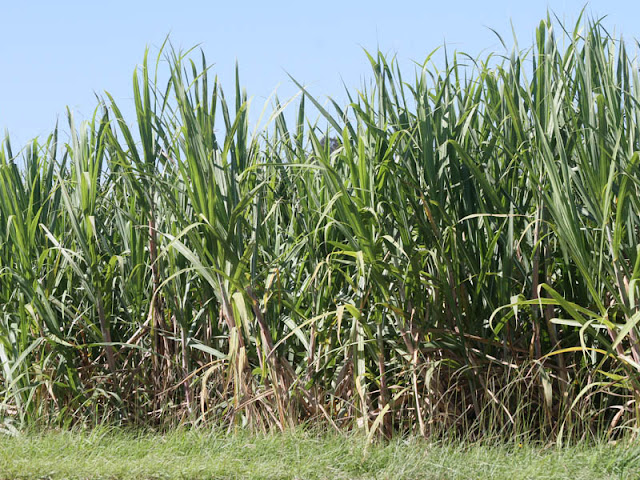
The Maclean district is recognised as the southern limit of the Australian sugar crop.
Gallery:
The Maclean sign which greets visitors to the town.
The stones in the cairn originated from many parts of Australia and Scotland, and are memorials to the contribution made to the settlement of Maclean by Scottish pioneers.
The Chiefs' Tartan Poles commemorate the 14 chiefs who have ruled since 1894. Five poles form the St Andrew's cross.
There are 240 tartan painted power poles in and around Maclean.
Shark Creek bridge near Maclean, formerly part of the Pacific Highway
River Street, the main street, with tartan telegraph posts and clan banners.
The Mathieson tartan on the levee in the park beside the Clarence River.
Timber buildings and brick buildings in the main street of Maclean.
Post Office in the background and the Sugar Derrick sculpture at the end of the main street.
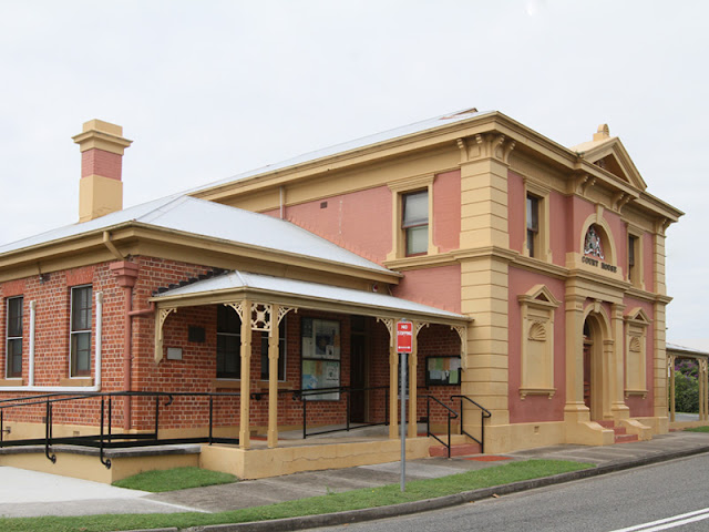
Maclean's Court House (1891) beside the Clarence River.
A boat moored at the town wharf on the Clarence River.
The Macgregor tartan telegraph post outside the local Presbyterian Church.
Sugar cane lines the sides of the road on the way into Maclean.
River Street Maclean looking down river. The building to the left of the main building in this picture, which became the Boulevarde Cafe, burnt down in 2006.
Tyler Photographic Studios, Maclean, 1910. A few of the buildings still remain. The nearest buildings were destroyed by fire on 27 Feb 2006.
River Street, Maclean, 1948 flood
Post Office and Mechanics Institute, Maclean, N.S.W. - very early 1900s
________________________________


No comments:
Post a Comment
Note: Only a member of this blog may post a comment.